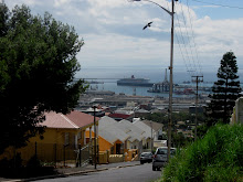
 Salt River, a suburb of Cape Town, started out as a swamp at the confluence of the Liesbeek and Swart (Black) Rivers that drained into Table Bay, near Cape Town's harbour. The plaque at the Van Riebeeck Hedge memorial (on my previous post) stated that the hedge ran along Wynberg Hill to somewhere near present day Newlands. "Beyond this the barrier continued as a pole fence to the mouth of the Salt River". The Salt River and swamp was only properly bridged in 1844, almost 200 years after Van Riebeeck landed, when Charles Michell built a causeway and a bridge (below - in a painting by Thomas Bowler) that opened up the "Hard Road" to Stellenbosch. These two images must be on pretty much the same spot as this circle is the confluence of several roads that radiate out in all directions - one of them being the "old" route to Stellenbosch.
  The bridge is called Montagu's Bridge after John Montagu, the Government Secretary of the Cape Colony. I am at a loss as to whether it still stands for the river is now a hideous concrete canal that runs through an equally hideous industrial area.
For more glimpses into other worlds, click here.


 Cape Town Time


Thanks for the interesting information in this post (and the ones below) on your part of our world.
ReplyDeleteThanks, too, for visiting my site.
Progress doesn't always bring beauty unfortuately
ReplyDeleteIt's amazing how cities just grow and grow. I'll bet it was beautiful in the old days.
ReplyDeleteHere in Port Elizabeth we have a stream that flows past the industrial area. Its also contained in a concrete canal and used to be called the Papenkuils River. These days its just known as Smelly Creek.
ReplyDeleteGreat post. I enjoyed reading it. Thank you for sharing its history.
ReplyDeleteThis is sooooo interesting. I sit in the traffic at this circle daily, going to and from my work! I wonder if Montagu's Bridge was not the bridge a bit further east from this spot, where Voortrekker Rd crosses the Salt River. I have a 1933 survey map indicating 'Vlei' just to the north of this bridge, and 'Varsvlei' to the south. I think Voortrekker Rd is double carriage at this point, so the original bridge is probably no more.
ReplyDeleteVery good information. Lucky me I discovered your website by chance (stumbleupon).
ReplyDeleteI have saved it for later!
Here is my blog post - http://www.jedheads.com/Manuel992/info/
golden goose
ReplyDeletecoach outlet
jordan 11
michael kors handbags sale
birkin bag
christian louboutin
adidas yeezy
nike shox for women
michael kors outlet
kobe basketball shoes
kyrie shoes
ReplyDeleteyeezy boost 350 v2
jordan 11
nike epic react
longchamp
jordan 13
kyrie 7 shoes
yeezy 350
golden goose sneakers
golden goose sneakers
cheap kyrie shoes
ReplyDeletekd shoes
paul george shoes
off white outlet
cheap jordans
bape
palm angels
kyrie irving shoes
bapesta
jordan outlet